Chulu east peak height is a part of the Manang Himal, that is pretty rightly inclosed in the larger Damodar Himal, the eastern restriction of which runs south from Chako and peak 6687 in a north-to-south path along the hunlung Khola, Nar Khola and Phu Khola. To the south, it's far bounded through the Marsyangdi Khola and the Mesokanta. There exists great confusion in regards to the call and vicinity of the Chulu peaks and what summit genuinely constitutes Chulu West and Chulu East, considering that it soon turns into obvious to everyone that has climbed in the range that several different summits close by, that are truly a part of the Chulu massif, aren't indicated on present maps of the region. For the sake of explanation, 4 summits may be covered within the Chulu group, two of which are feasible at the allow for Chulu West and two at the Chulu East permit. What is apparent is that the available trekking map is relatively misleading.
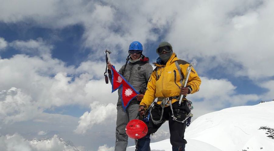
A climb those trekking peaks blended with Nepal's most famous across the Annapurna trek make up for one of the maximum astonishing Himalayan trekking and mountaineering outings.The obvious technique to this peak diverges from the main trail to the Thorung la pass beyond the village of Manang and Base Camp is hooked up in a small valley to the North. From base camp the path follows a subsidiary North-West ridge that leads as much as the main peak. An try to the peak and go back has be completed in a single day as placing camp up on the slope above base camp is not easy.